

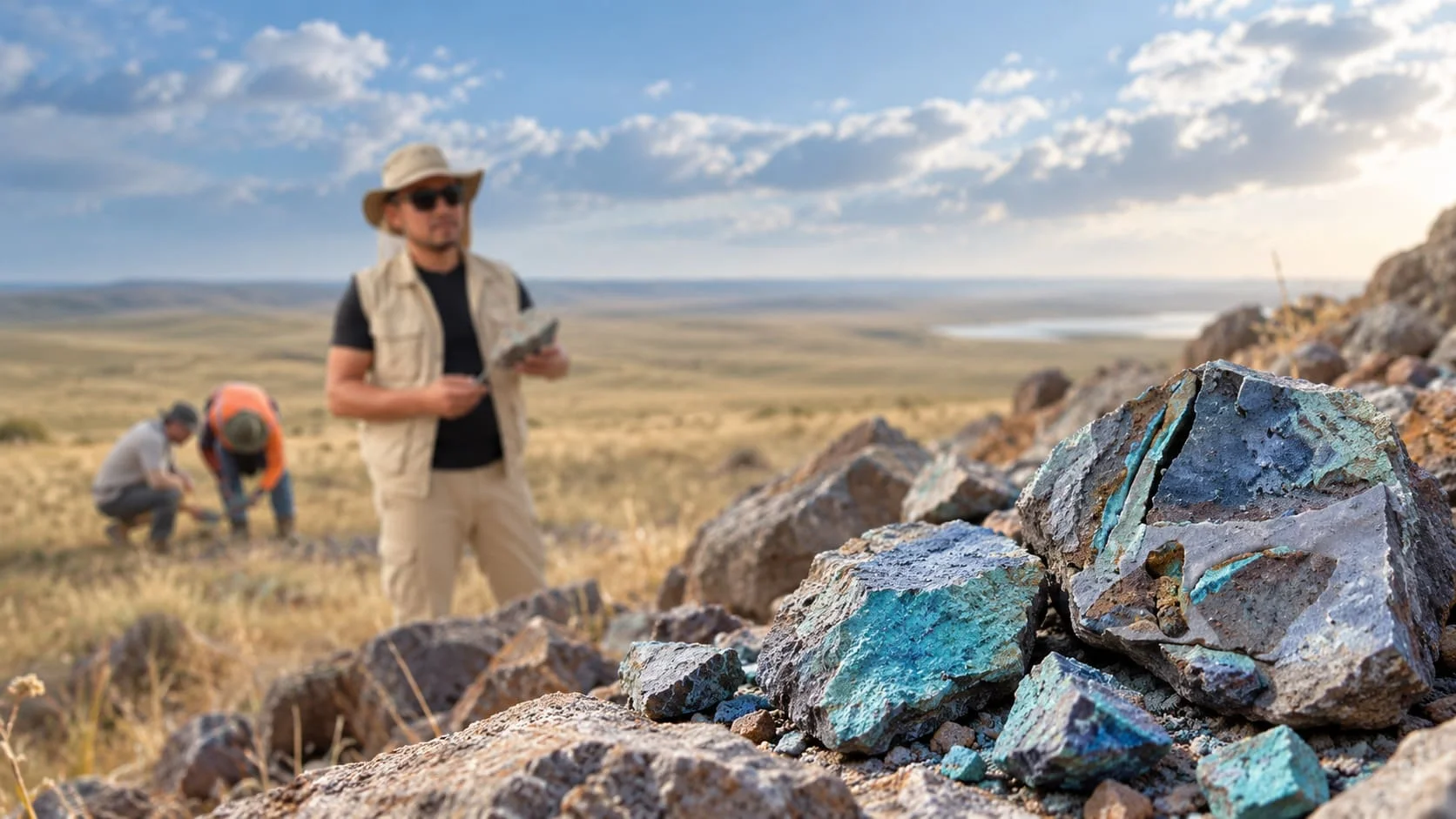
Teniz is located in the northern part of the Teniz–Chu-Sarysu copper belt, a region recognized for its potential to host sediment-hosted copper deposits.
Teniz shares a number of key geological and structural characteristics with the Zhezkazgan copper system, including prospective host stratigraphy, permeable horizons, deep-seated structures, and the presence of reducing environments favorable for copper precipitation.
The project is located approximately 3 hours by paved road from Astana to the town of Atbasar, where the field office will be based (about 100 km north of the southern licence area and about 15 km south of the northern licence area). The southern licence area is a further 2.5 hours away via established dirt roads. The terrain consists mainly of open steppe, locally crossed by shallow streams, and seasonal access restrictions may occur during the spring period.
Unlike the extensively explored southern parts of the belt, the Teniz area has historically seen significantly less modern, systematic exploration.
Exploration within the project area has identified:
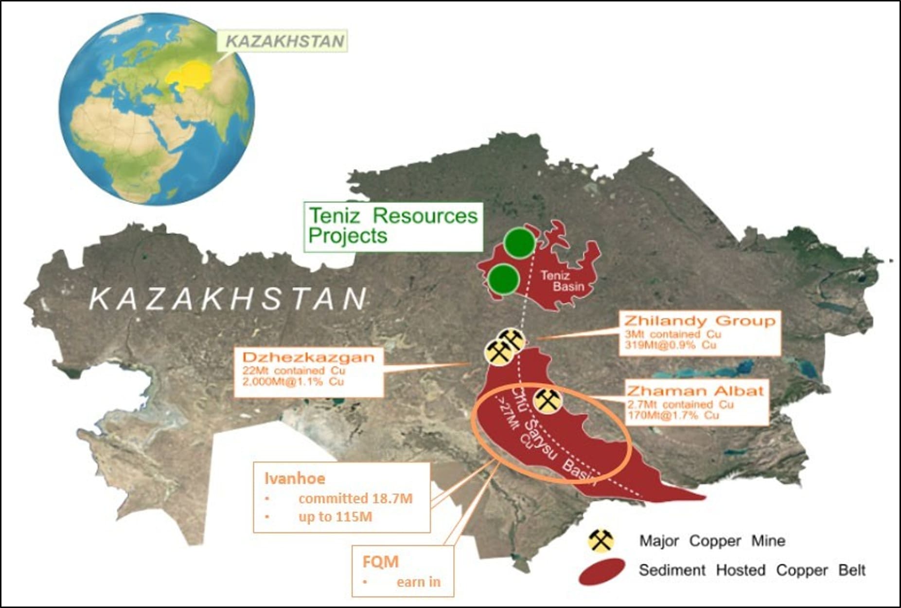
Teniz is located within the Teniz Basin, a prospective and underexplored region for sediment-hosted stratiform copper deposits in Central Kazakhstan. The project lies approximately 250 km north of Zhezkazgan, one of the region’s largest copper systems.
Teniz exhibits a number of key geological characteristics comparable to the Zhezkazgan system, including prospective host stratigraphy, a similar structural architecture, permeable horizons, the presence of reducing environments, and potential pathways for the migration of metal-bearing fluids.
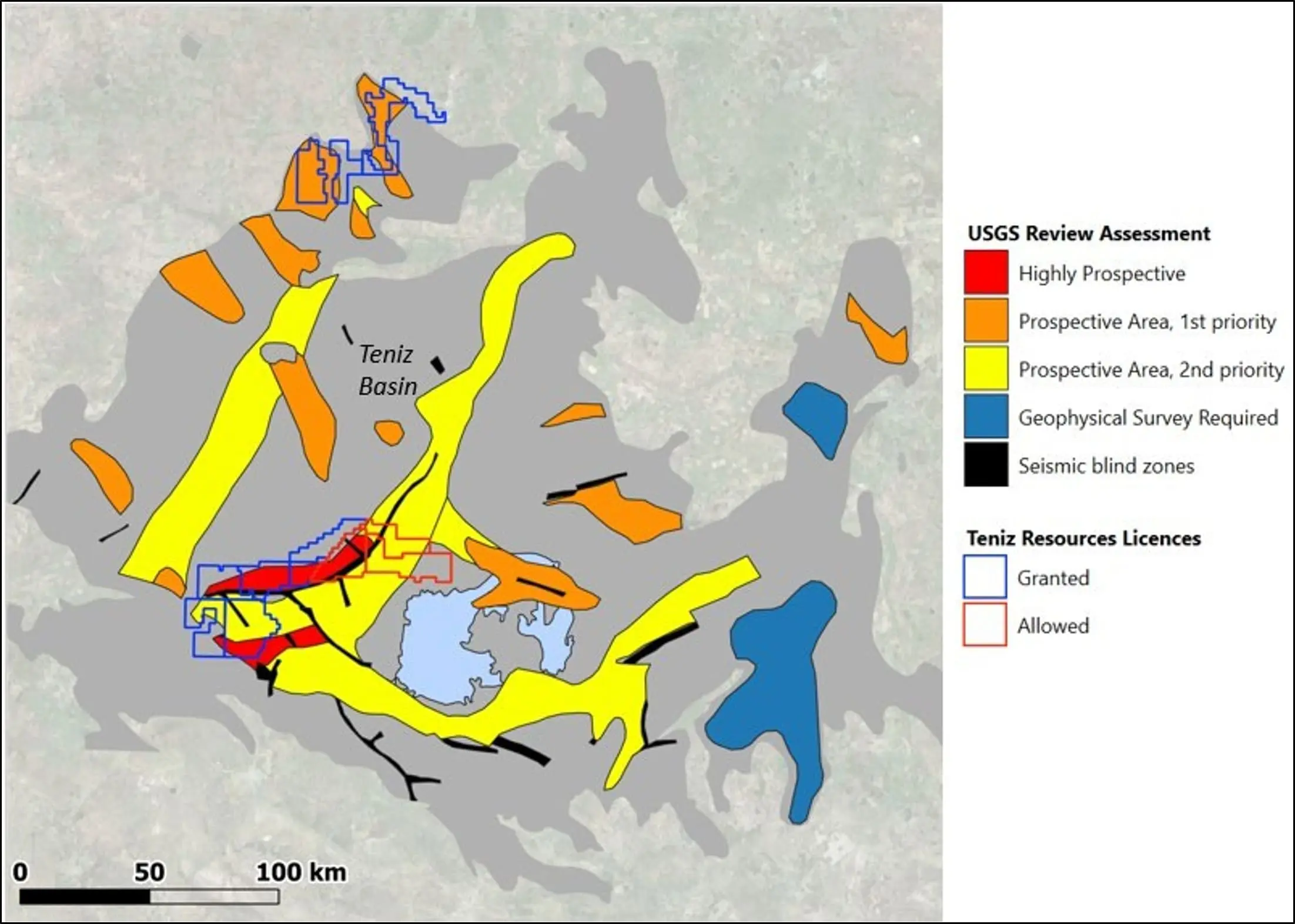
The USGS has identified a significant portion of the Teniz Basin as prospective for sandstone-hosted copper deposits. As part of its basin-wide probabilistic assessment, the USGS estimated a mean of nine undiscovered deposits containing approximately 8.9 million tonnes of copper at the 30% probability level. This assessment applies to the entire basin and does not represent a resource estimate for Teniz Resources.
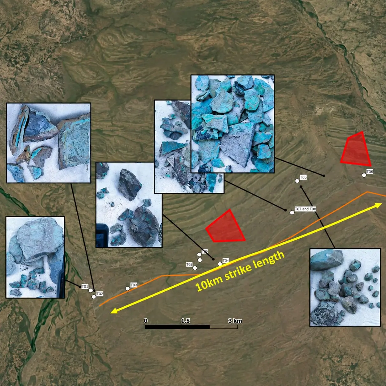
Historical Soviet-era data and recent fieldwork further support the project’s prospectivity. Copper geochemical anomalies and mineral occurrences have been identified across an area exceeding 75 × 30 km, while surface copper mineralization has been confirmed over a strike length of more than 10 km. Within Targets 1–2, historical drilling defined a combined historical resource estimate of 2.36 million tonnes grading an average of 1.42% Cu.
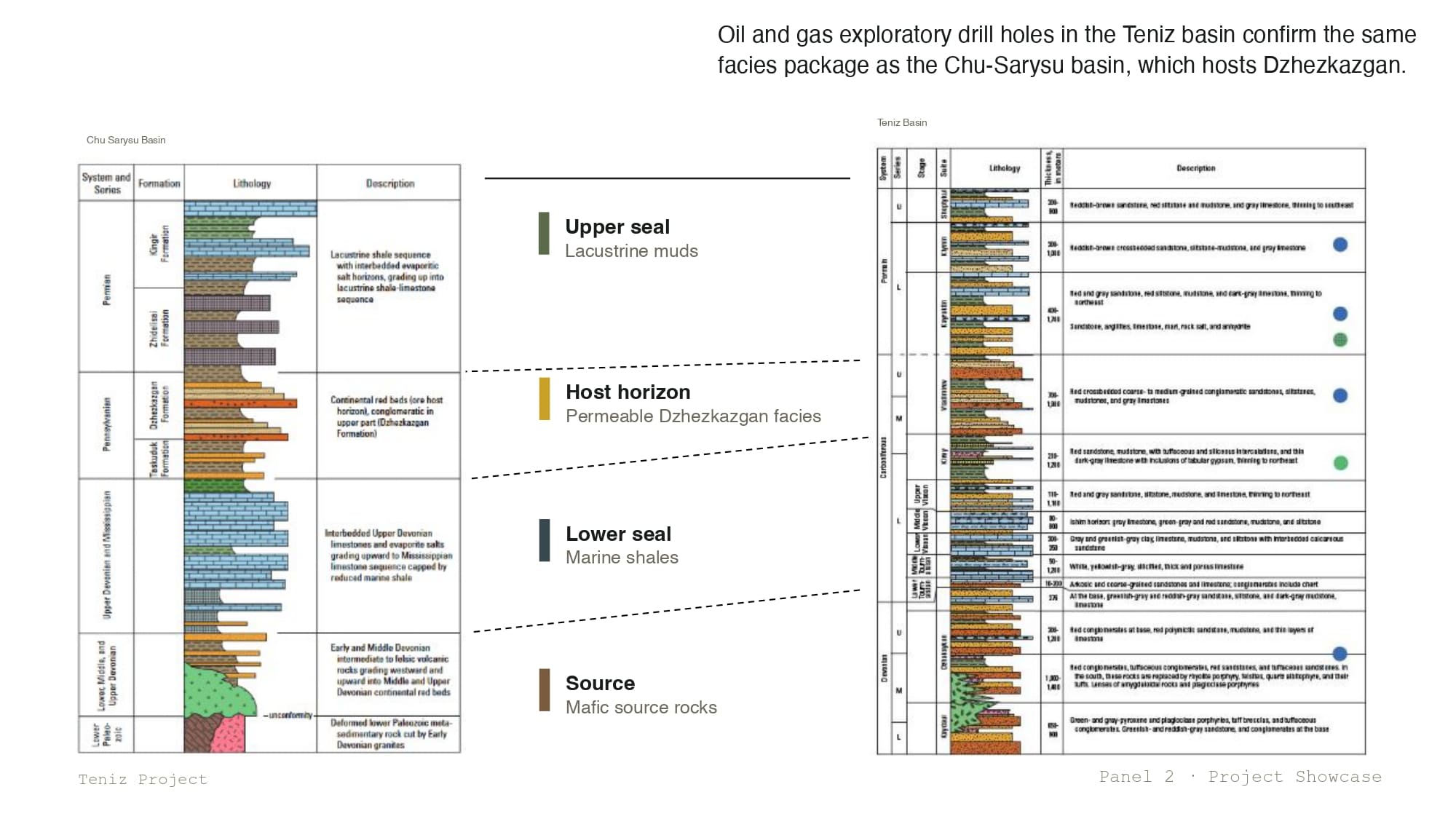
A World-Class Geological Model
Zhezkazgan is the largest known copper system in the region and serves as the principal geological analogue for Teniz. The project is located approximately 250 km north of Zhezkazgan, within the same major Teniz–Chu-Sarysu copper belt.
The Zhezkazgan system is characterized by a combination of several key factors:
Permeable Host Horizon
Copper-bearing brines migrated through laterally extensive permeable sandstone units that served as regional host horizons for mineralization.
Deep-Seated Structures
A network of faults and fold structures provided pathways for the migration of metal-bearing fluids.
Reducing Environment
The interaction of oxidized fluids with reducing agents created favorable conditions for copper precipitation.
Structural Traps
The most significant mineralization at Zhezkazgan is associated with zones where major structures intersected, creating favorable traps for copper concentration.
Why This Model Matters for Teniz
Historical and modern exploration at Teniz indicates the presence of key geological elements comparable to those of the Zhezkazgan system:
How Potential Copper Mineralization Forms
The Teniz exploration model is based on a geological system analogous to that of Zhezkazgan.
Metal-bearing fluids migrate through permeable host horizons and deep-seated structures. Where these fluids interact with a reducing environment and favorable geological architecture, conditions are created for the precipitation and concentration of copper.
At Teniz, the key elements of this model include:
Vladimirov Formation
A prospective host horizon that is considered a direct facies analogue of the principal ore-hosting formation at Zhezkazgan.
Koptepky Anticline
A major fold structure along which copper occurrences have been traced for more than 50 km.
Deep-Seated Structures
Three major transverse structures that may have provided pathways for the migration of mineralized fluids.
Reducing Environment
Historical drilling intersected methane at a depth of approximately 812 m in the Koptepky Anticline area, indicating the presence of a potential reducing environment.
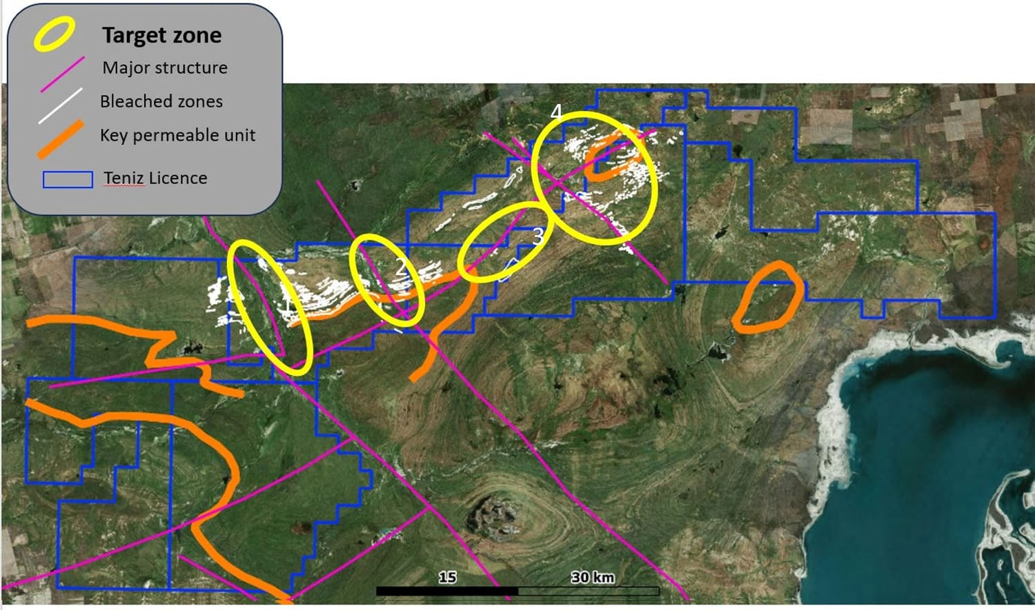
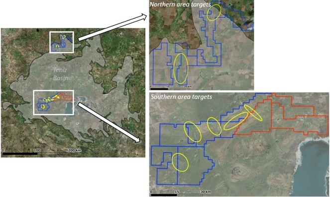
Based on historical data and the modern interpretation of geology, geochemistry, and geophysics, five priority target areas have been identified within the southern part of Teniz. An additional two targets have been defined in the northern part of the project, while eight further prospective targets occur within approximately 4,000 km² of surrounding ground that remains open for future licensing.
Target 1
A large structural target characterized by a pronounced Cu–Pb–Zn ± Ag anomaly and confirmed structural control on mineralization.
Target 2
A zone of elevated copper values located adjacent to a major transverse structure. Historical drilling indicates an increase in mineralization in close proximity to this feature.
Target 3
A 15 km-long structural saddle associated with a historical gravity anomaly and a potential dome-shaped trap at a depth of approximately 300-400 m.
Target 4
A structural target within the Koptepky Anticline, where favorable stratigraphy coincides with major structural features.
Target 5
A southwestern target defined by the combination of an IP anomaly, deep-seated structures, and historical copper mineralization.
Throughout 2026, Teniz Resources is undertaking a comprehensive exploration program focused on three parallel workstreams:
The objective of the program is to advance priority targets to drill-ready status.
Under License No. 3308-EL, an option agreement is in effect with CAML XD Limited (a subsidiary of Central Asia Metals plc): CAML XD has been granted an exclusive option to acquire the asset and is funding the exploration program on this property, including drilling.